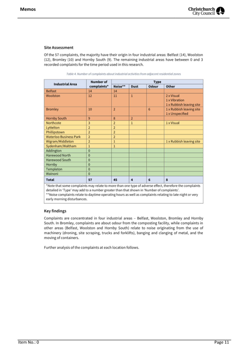
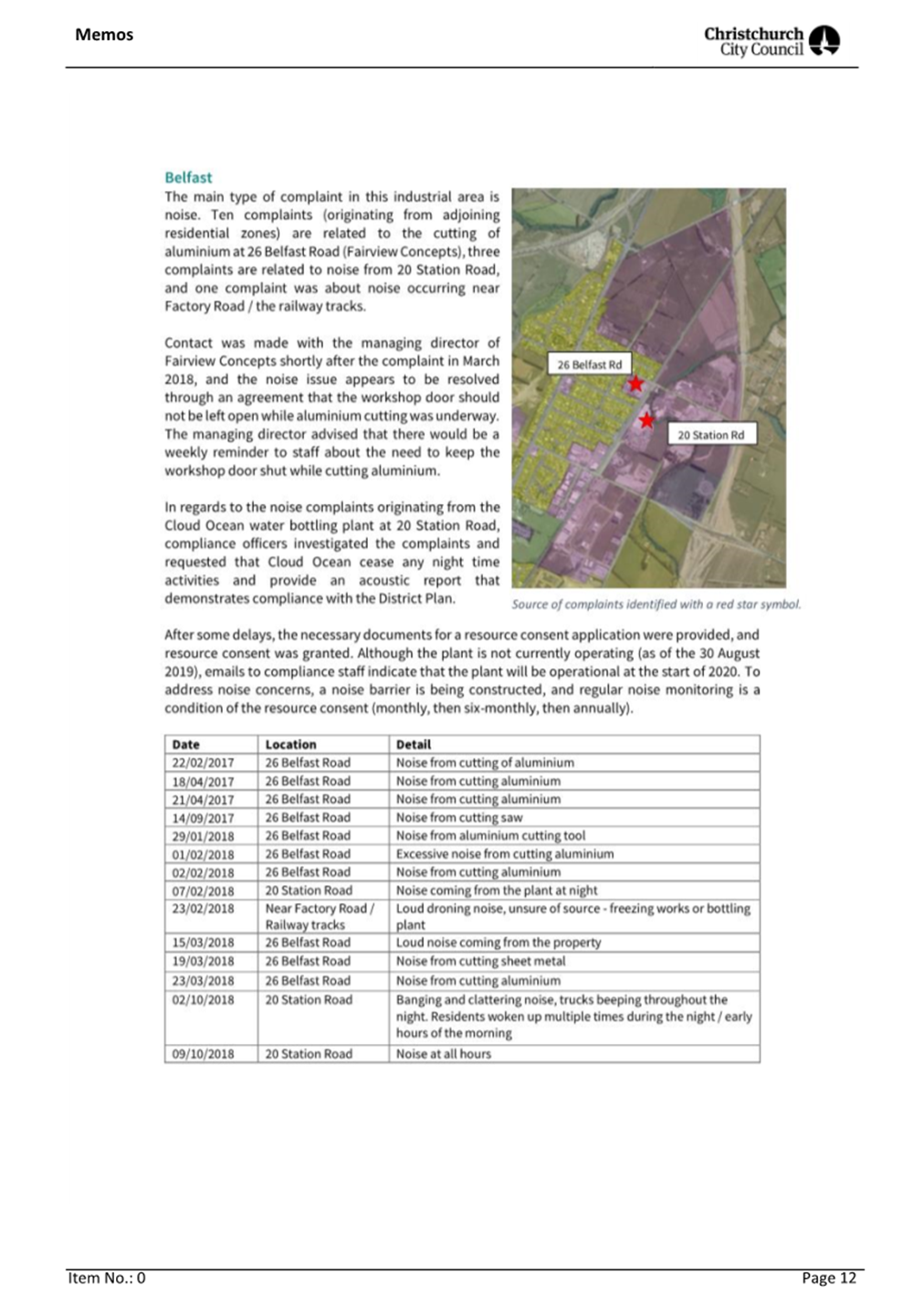
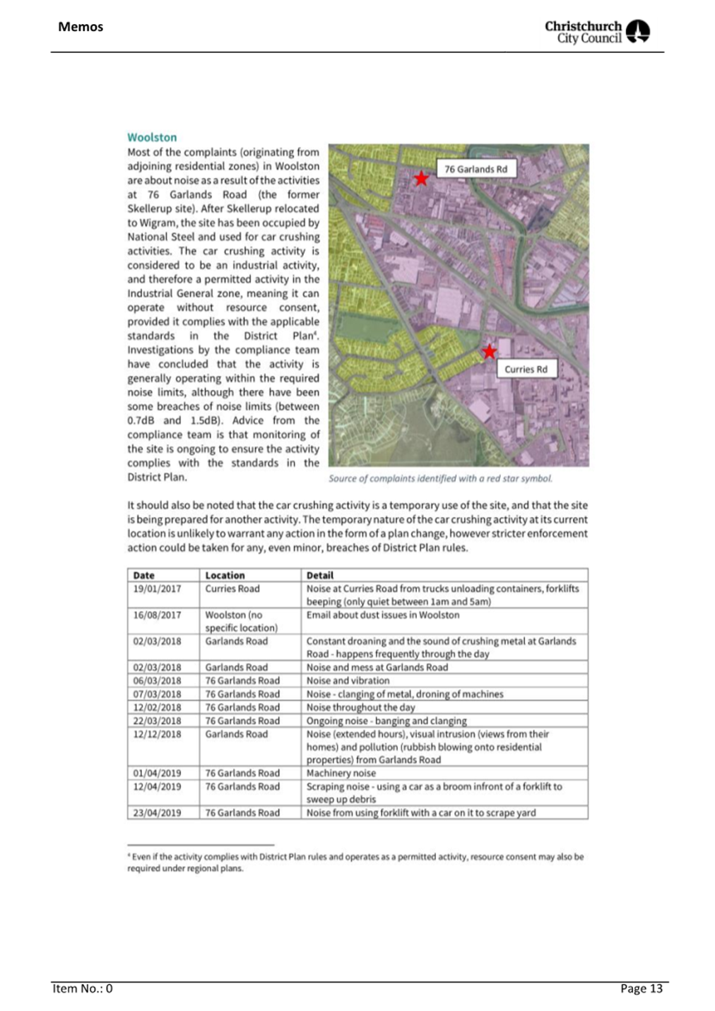
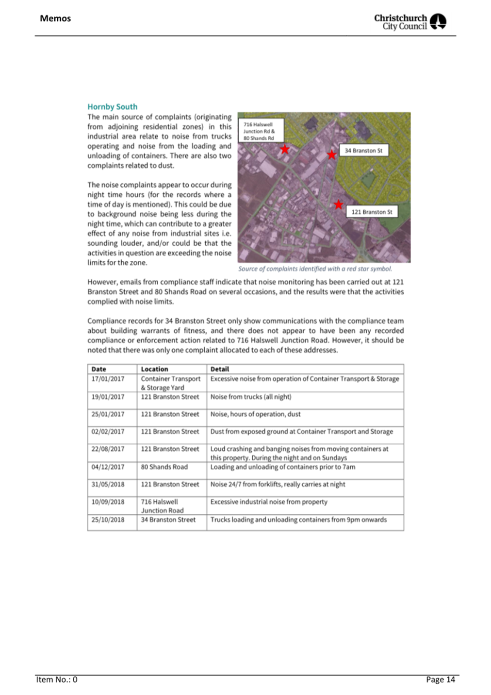
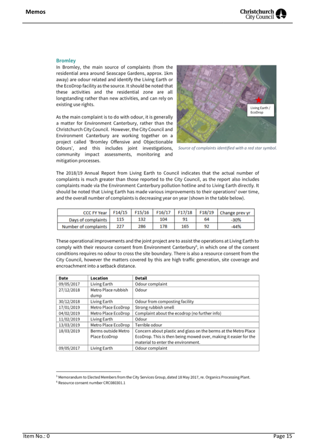
|
Items of
interest include:
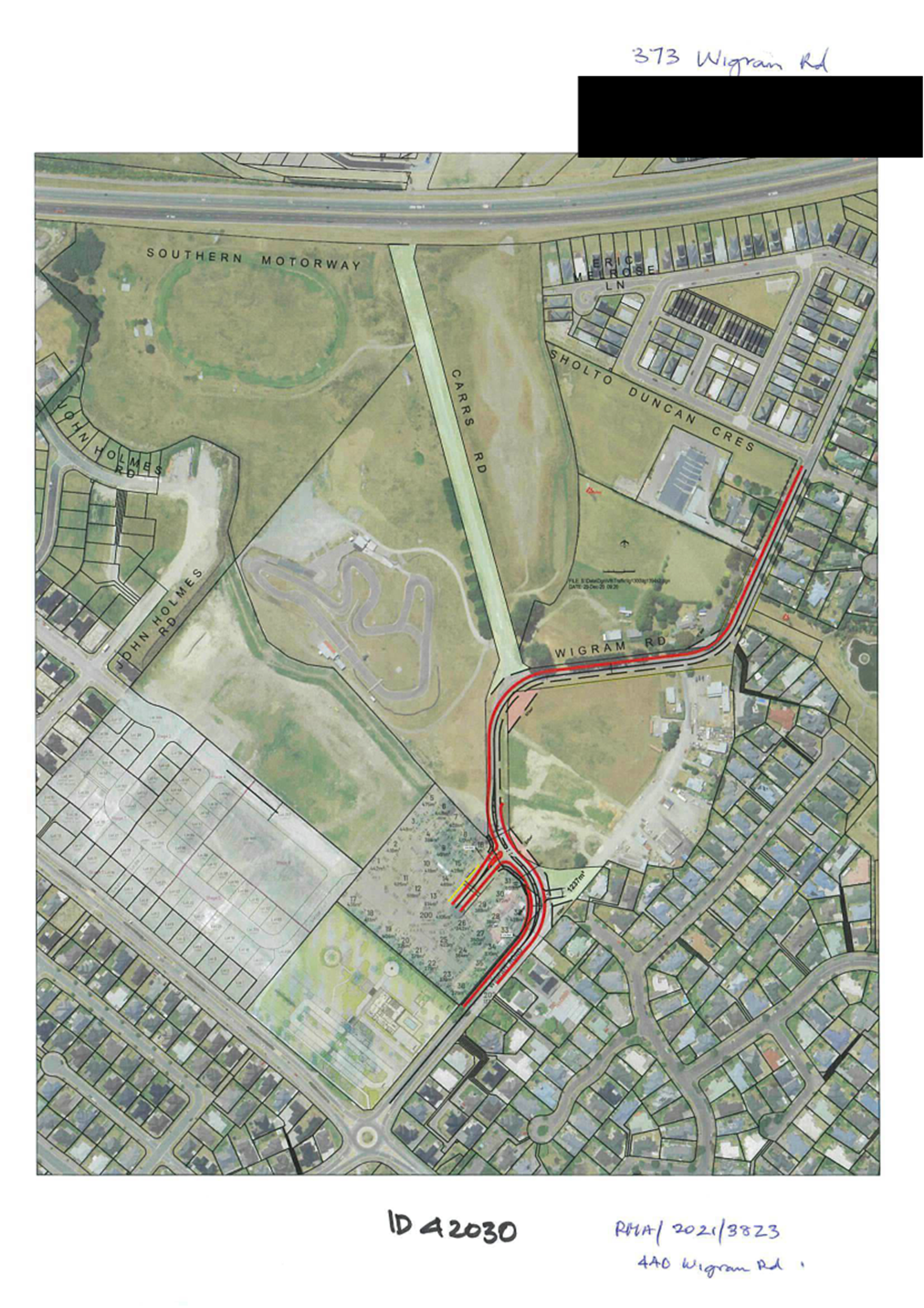
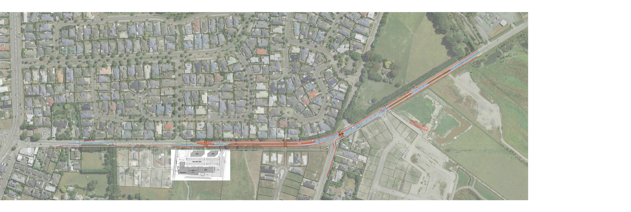
1. Realignment
of Wigram Road
This project is
a Resource Consent’s condition for the development at 448 Wigram Road.
The development creates an opportunity for Council to realign the current
sharp bend to a much improved road environment for a 60 kph road. Developer
will deliver this project to service its development. On completion the
carriageway on Wigram Road east of Halswell Junction Road to Carrs Reserve
will consist of 2 x 3.2m vehicular lanes, 2 x 1.8m cycle lanes and a 2.5m
shared path along the northern side of Wigram Road.
This project is planned for completion in July
2025
A Report will
be presented to the Board at some later date for the approval of regulatory
road marking required, declaring special lanes on road, shared path and
traffic management measure for the new intersection including special
vehicle lanes (cycle lanes) along the section of existing Wigram Road west of
this Project
Attachment A shows
the overview of the realignment at 440 Wigram Road and Attachment B shows the high-level plans for the wider area of
Wigram Road
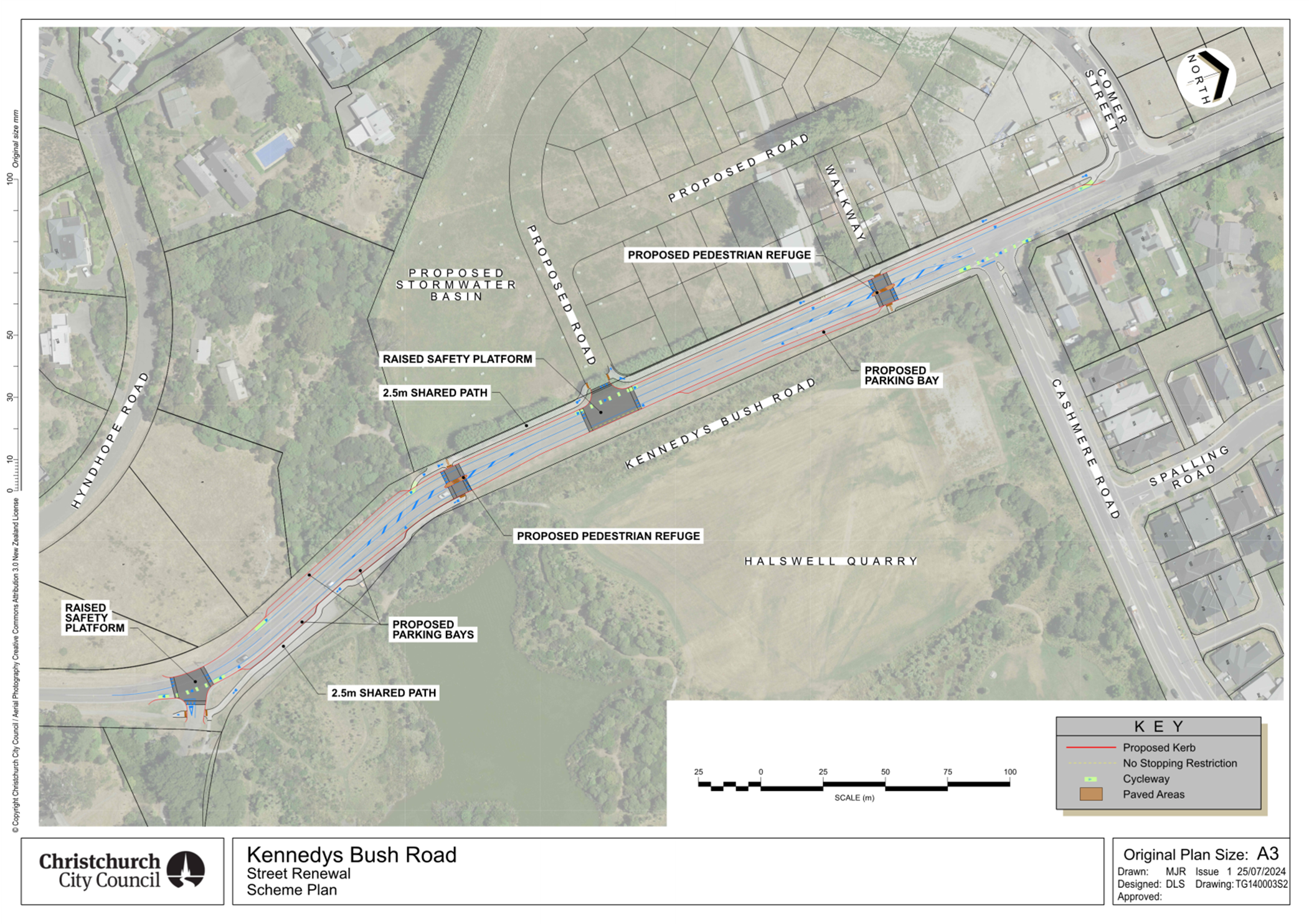
2. Kennedys
Bush Road Upgrade
A section of
road between Cashmere Road and the Quarry Park entrance is required to be
upgraded. The scheme plan is shown on Attachment C. The upgraded road will accommodate 3.2m vehicle
lanes in each direction, with on-road cycle lanes. Traffic control measures
will also be constructed to manage vehicle speeds and create a safer road
environment. These traffic measures include platforms at the intersection of
Kennedys Bush Road with the Quarry access, the intersection with the proposed
new subdivision road, and at the 2 new pedestrian refuges.
The frontage
upgrades alongside Oakvale Farm on the western side of Kennedys Bush Road,
including two pedestrian crossings linking to Halswell Quarry, is a resource
consent condition. The extent of the work required provides Council the
opportunity to upgrade the remaining section of the road as described above
and also includes the forming of on-road, indented car parking spaces. This
work also includes the drainage control of road runoff.
Formal approval
of regulatory road markings, including the declaration of on road cycle lanes
and the shared path from Glovers Road and Quarry Park Entrance, and traffic
management measures to mitigate the safety issues raised in the traffic
safety audit process will be required. This is intended to be brought to the
Board with a decision report in March 2025.
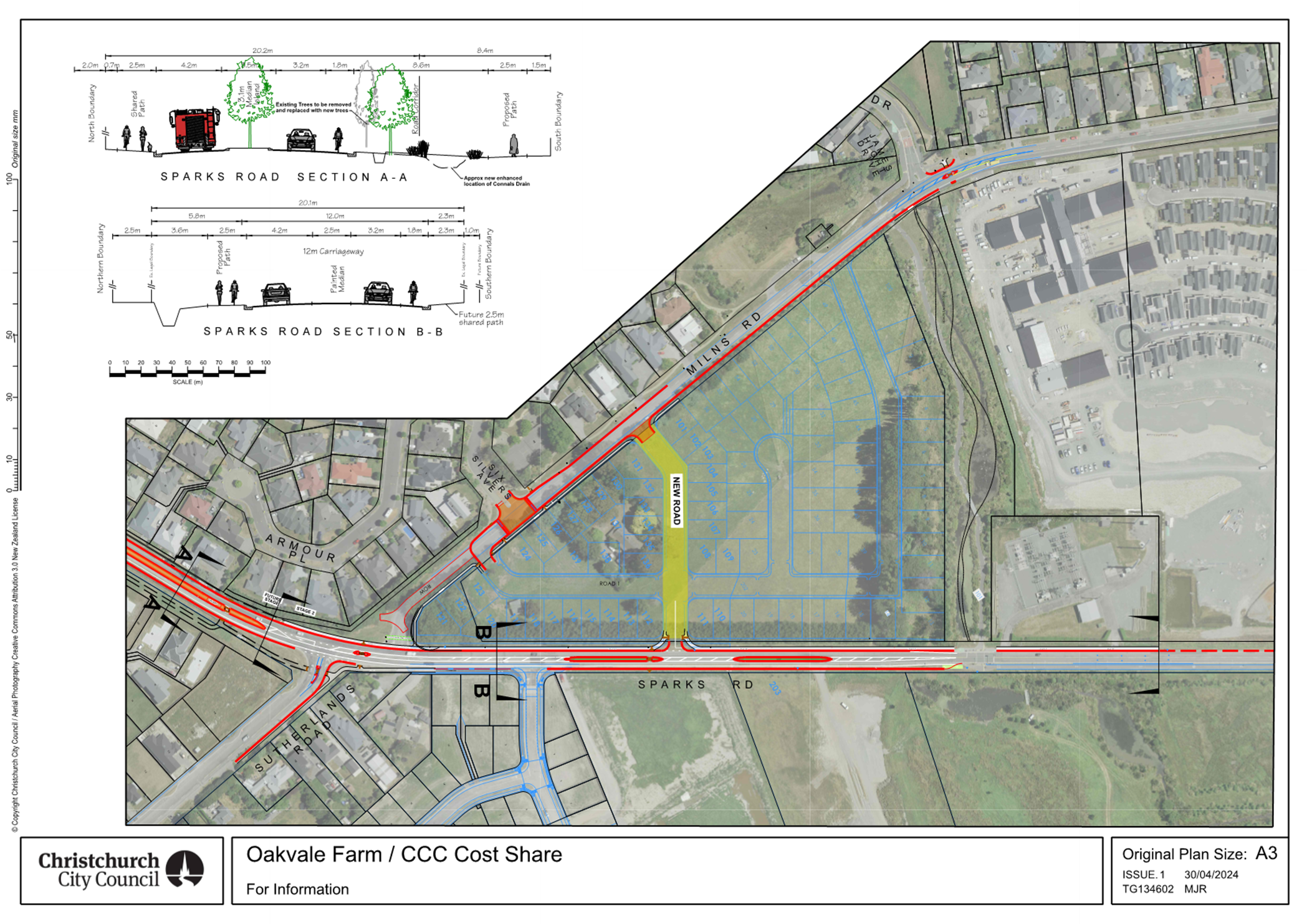
3. Sparks
Road Upgrade between McCartney and Traffic Lights by Milns Drain
(Including
Resource Consent’s requirement to enhance Cashmere Stream across
Sutherland)
This upgrade
project will be delivered in partnership with five developers, with frontage
upgrades forming a condition of each development. The Sparks Road area plan
is shown in Attachment D.
There were
challenges to develop a scheme that could accommodate all the elements of a
minor arterial road, due to the constraints caused by Connal Drain being
within the road corridor. Staff were involved in prolonged discussions with
stakeholders, and the final design outcome has been agreed with respective
developers for the delivery.
The upgrade
also includes the relocation of the existing Milns and Sparks intersection,
which the Community Board has been briefed on previously. The intersection
relocation is a condition of consent for the development at 179 Milns Road.
The road
upgrades will consist of cycle lanes, traffic median, shared paths and
pedestrian refuges. Traffic management in the form of platforms are proposed
to mitigate the safety concerns raised in the Traffic Safety Audits.
An upgrade of
Milns Road is also included in this project, including the construction of a
footpath on the eastern side to connect Milns Drain to the path outside the
retirement village. Milns Road upgrades are shown on Attachment E.
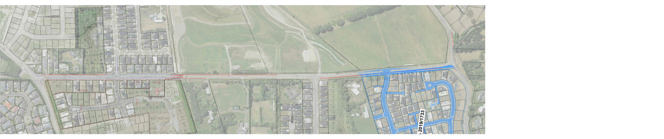
Update:
Cashmere Stream enhancement Project was a Resource Consent for the
development at 95 Sutherland Road. This project includes a safe pedestrian
crossing linking the path to the stormwater facilities east of Sutherlands
Road, including kerb and channel, platform and road narrowing where
Sutherlands Road crosses Cashmere Stream.
Formal approval
of regulatory road markings, including the declaring of the special on-road
cycle lanes and shared path, and traffic management measures for Sparks and
Sutherlands Roads will be required. This will be presented to the Board at a
later date.
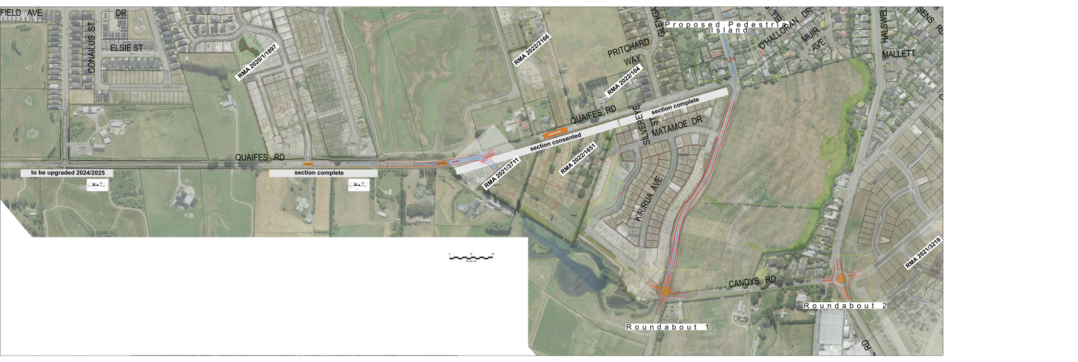
4. Quaifes
Road Upgrade between Murphy Road and Sabys Road
There has been
significant work along Quaifes Road over the last 5 years, with developments
carried out by various stakeholders. This has included installation of
underground infrastructure to service these developments.
In recent years
Council upgraded the Quaifes/ Murphys Road intersection with a raised
platform. This was an environment with very similar constraints to a similar
intersection at Quaifes / Matai Springs which was constructed several years
ago as part of the Matai Springs subdivision. This was necessary to provide a
safer road network in a constrained road space in accommodating existing
drains along both sides of the road, which means it is not possible to
provide sufficient width right turning bays typically required for this speed
environment. The platform was introduced to mitigate the safety concerns
raised in Traffic safety audits.
The developer
of 63 Quaifes Road will realign a section of Quaifes Road, connecting to
Candys Road in accordance with the Outline Development Plan for the area. A
high-level plan of the Quaifes / Sabys / Candys Road changes is shown in
Attachment F.
Formal approval
of regulatory signs and road markings and other aspects along Quaifes Road
will be required. This is intended to be brought to the Board with a decision
report in March 2025.
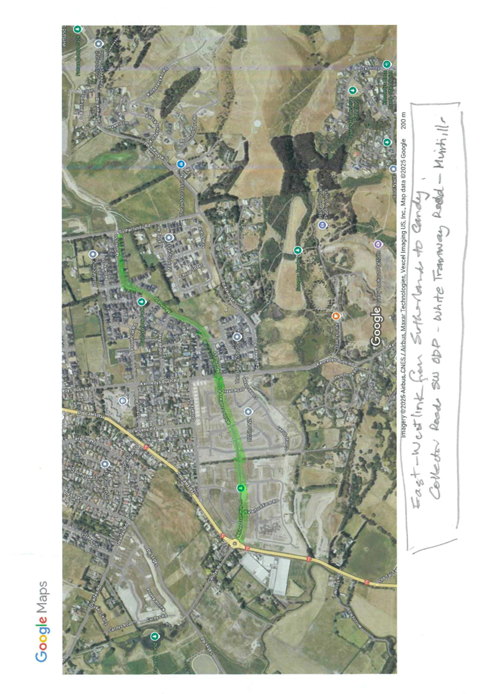
5. Formalising
East-west collector road link between Sutherlands Road and Candys (Muirhill
Road & Whites Tramway Road)
This East
– West link was progressively constructed at various stages of
subdivisions over the last 15 years. The Outline Development Plan (ODP) and
conditions of consent required developers to deliver on road cycle lanes and
a shared path along the road corridor. In addition to the road width required
to accommodate cycle lanes, on road cycle lanes were required to be delivered
and marked for most sections, however there were gaps of road that remain
unmarked particularly from older stages of subdivision, and additional no
stopping markings are required.
Council has
received a number of complaints regarding parking in the cycle lanes, and it
is proposed to complete the road marking to finalise the outcomes expected by
the ODP and the District Plan.
At a
later date, a report will be presented to the board in order to approve
regulatory markings that will give effect to the intended use of the road,
and allow for the regulatory markings to be enforceable. Staff will seek
advice from the engagement team on the engagement required for a board
decision on this.
|